
Walk a Shreveport Street
A sound address search moves from land to people evidence. The Caddo Parish Assessor identifies an assessed owner, while the deed index explains how that legal interest reached the current name. Voter and directory records are narrower and date-specific. Keep the situs address, where the parcel sits, separate from the owner's mailing address.
- Enter the street number and name in the Caddo Assessor search. Save the parcel ID, situs, owner, legal description, subdivision, and map link.
- Open the parcel map and inspect nearby polygons. Compare each map result with its assessor card.
- Use the legal description and owner name in eClerks LA, then follow grantors and grantees through Caddo conveyances.
- Check the official voter address tool only for the limited result it supplies.
- For older households, consult Shreve Memorial Library's address and phone directories, logging the volume year.
This route makes the Shreveport street directory auditable. A map pin becomes a parcel, the parcel becomes a legal description, and the legal description anchors a deed search. A directory entry can then be compared without being mistaken for present occupancy.
Search Shreveport Parcels by Address
DataScout supports more than an owner-name query. Omit the street type in the street-name field. If an address misses, try parcel number, property ID, subdivision, or Section-Township-Range. Paid professional fields may add transaction history and history cards, but the free result is the practical first check.
| Field | Format | Purpose |
|---|---|---|
| Street Number | Text | Pairs with street components |
| Direction | N, S, E, W | Separates directional streets |
| Street Name | Omit type | Finds address matches |
| Parcel Number | Exact with dashes | Returns a known parcel |
| Property ID | Numbers, no dashes | Alternative identifier |
| Subdivision or S-T-R | Local land description | Finds land when the civic address fails |
The official parcel-search help shows the controls.
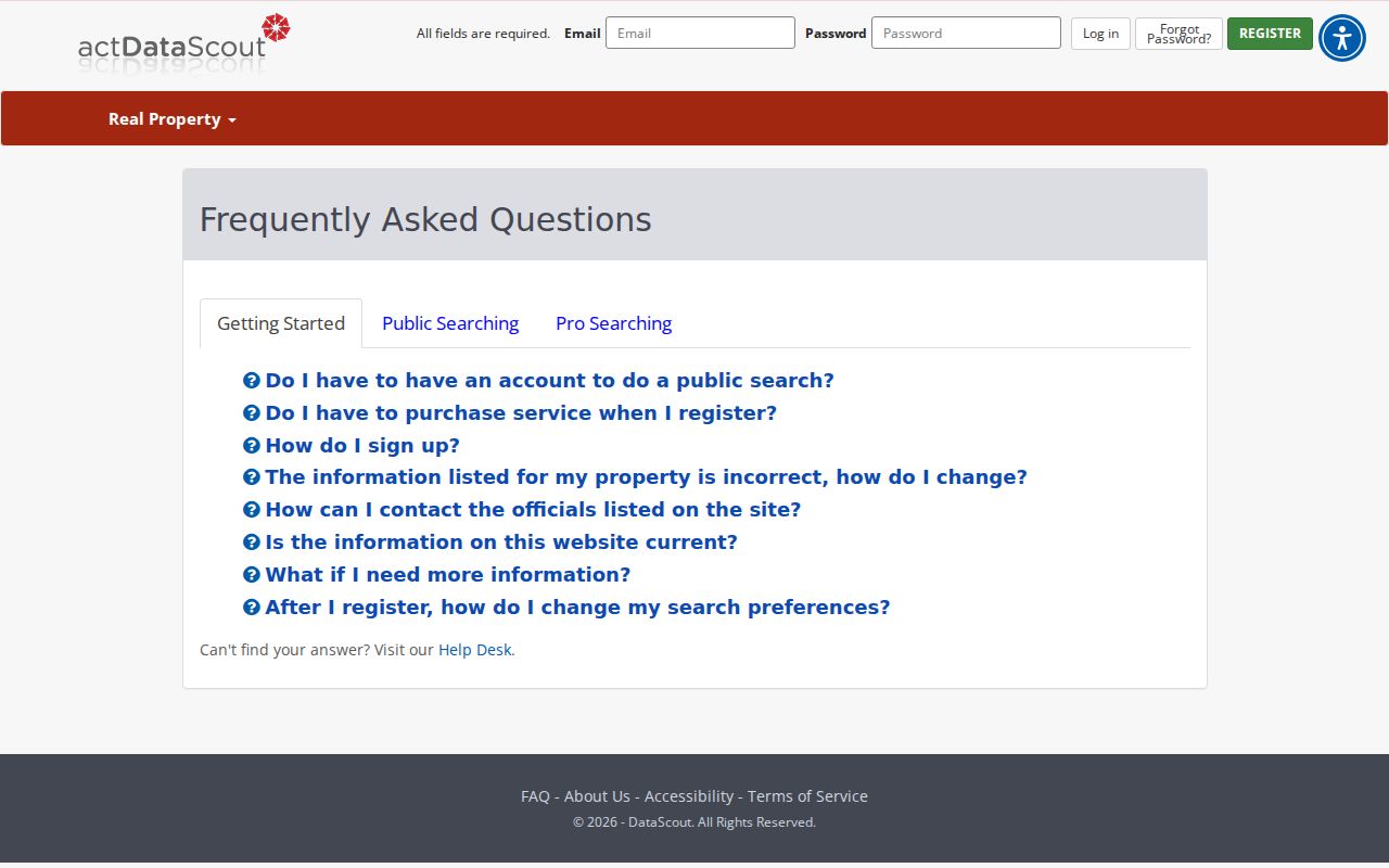
The captured screen supports the key rule: use structured parcel fields, then inspect the returned card. A mailing address is useful, but it does not prove occupancy.
Shreveport Street Record Coverage
Each source contributes a different layer. The Shreveport street directory works best when the log names the keeper, access route, date, and limit.
| Address Source | Keeper | People Signal | Access |
|---|---|---|---|
| Assessor roll | Caddo Assessor | Assessed owner and mailing address | Free search; paid expanded fields |
| Parcel and zoning map | Assessor, MPC, City GIS | Linked and nearby parcels | Public or subscriber map |
| Deed and plat | Caddo Clerk | Grantors, grantees, heirs, estates | Free index, paid images, office books |
| Voter record | Louisiana SOS | Limited registration evidence | Public lookup or paid defined list |
| Permit | Shreveport Permits | Applicant, contractor, work dates | MGO; request older files |
| Directory | Shreve Memorial Library | Dated occupant or subscriber | Print, microfilm, selected digital volumes |
The parcel ID and legal description form the strongest bridge. Record whether each hit is an owner, voter record, applicant, or dated listing.
- Parcel
- A mapped unit of land with its own property identifier.
- Situs address
- The physical property location, unlike the owner's mailing address.
- Plat
- A recorded map of lots, blocks, streets, or a subdivision.
- Criss-cross directory
- A directory arranged by street or phone rather than only by surname.
Map Shreveport Streets and Parcels
The Shreveport-Caddo MPC Property Address Lookup offers zoning and parcel context. Search the street, click the subject polygon, copy its details, and inspect adjacent polygons one at a time. Caddo Assessor mapping links parcels to cards, while City GIS maintains a municipal layer. These tools help with corner lots, multi-address parcels, schools, churches, and boundary roads.
GIS lines are approximate. The City disclaims accuracy, completeness, reliability, timeliness, and usefulness. Use a recorded plat or custodian confirmation when a boundary matters. Caddo map requests are a fallback and ask for map type, layers, size, copies, and boundaries.
Connect Shreveport Streets to Deeds
The Caddo Clerk holds conveyances, mortgages, liens, cancellations, and plats. Land instruments are generally indexed by party and legal description, not a modern USPS address. Find the assessor owner as grantee, read the seller as grantor, and compare lot, block, subdivision, or Section-Township-Range before accepting a match.
Images reach 1839, yet digital indexing is uneven. Direct conveyance indexing begins in 1914, indirect indexing in 1983, and mortgage indexes in 1981. Earlier work may require alpha books, entire-book views, book and page references, or the Record Room. Pre-1951 registry numbers can repeat, so page and legal description matter.
Start with free eClerks, then use Clerk Connect, courthouse books, or the written copy route. General copies cost $1 per page plus postage. Note: A mortgage certificate is a defined record search, not a title examination.
Shreveport Permits Add Address Dates
MGOConnect supports searches by permit number, address, or name and may show project type, dates, status, applicant, contractor, inspections, and plans. Older inspection logs and plans remain part of a scanning effort, so a missing online result should lead to a records request.
The current permit route shows the workflow.

The image identifies the active channel. An applicant or contractor has a project link, not proven occupancy.
The Property Standards concern route requires an issue address.
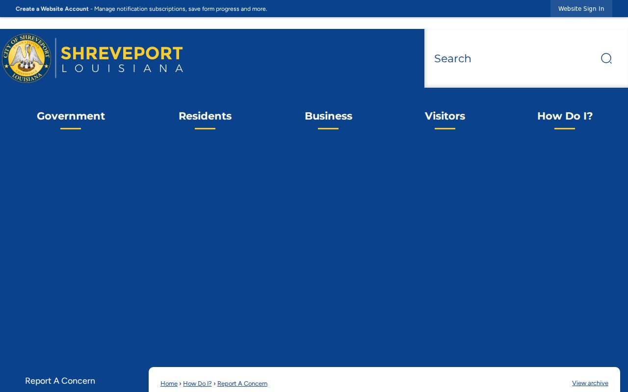
This capture shows the public fallback. Ask the City custodian for the underlying file when the status view is incomplete.
Shreveport Voter Records by Address
The GeauxVote address search asks for ZIP, address, Apt/Lot, and city. Louisiana says public voter records and address records are not linked for protection. One return is not a roster of adults at the address.
A purchased list is different. It can be selected by parish, ward, or precinct and may include residence and mailing address, registration details, districts, status, and vote-history fields. The state requires an account, estimate, advance payment, and set output format. Protected participants and confidential data remain excluded, and ballot choices never appear.
Old Shreveport Street Names
A historical crosswalk lists circa-1932 changes such as 1st or Agurs to Levee, 2nd to Cadillac, 3rd to Thatcher, 7th to Highland Avenue, Adams Avenue to Gladstone Boulevard, and Caddo Avenue to Tulsa Avenue. Treat it as a bridge, then verify with a directory, map, deed, or city record.
Spelling drifts too. A 1920 census reference uses “Dellaware” for Delaware. Preserve the printed form and test variants. The same place may be indexed by ward, neighborhood, subdivision, old street, new street, or legal description. Shreve Memorial's reverse volumes are dated street tools; the Shreveport directory book page covers the collections.
Limits of Shreveport Street Directory
An assessor owner is not a household list. Mailing addresses may point elsewhere, parcels can include many units, directories grow stale, and permits name project participants. Voter access excludes protected and private fields. Utility customer, private motor-vehicle address, delivery, and unlisted phone data are not open street sources.
Give each claim a source date. Correct assessor errors with the assessor, deed errors with the Clerk, map issues with the GIS custodian, and voter issues through the registrar. A no-result may mean an older handwritten book, name variant, wrong index, or request-only record.
Lawful use. Shreveport address records support lawful personal research, family history, property study, and civic inquiry. Never use them to stalk, harass, intimidate, or harm anyone.
Keep a Shreveport Address Log
A street-wide project becomes hard to check unless every hit has the same core fields. Preserve the address exactly as printed, a normalized modern address for new searches, unit or building number, side of street or corner position, parcel ID, legal description, USPS ZIP result, and the city or parish authority responsible for the site. Add the source name, result date, and record role. A permit applicant, assessed owner, deed grantee, directory subscriber, and registered voter are not interchangeable labels.
Apartment buildings and parcels with several situs addresses need extra care. One parcel polygon can cover many delivery points. A church, school, common area, or tract without a conventional number may appear under a land description instead. Conversely, one civic number can produce records for more than one unit. Keep the raw result beside any cleaned address so another researcher can reproduce the search.
Use dates to resolve conflicts. An older directory occupant may be correct for its edition while differing from a current assessor owner. A permit can fall between two deeds. A voter result may reflect a separate update cycle. Do not erase the conflict. Write what each custodian showed, then seek a second dated source before attaching the person to the parcel.
Access notes belong in the log too. The Caddo Clerk's free eClerks index is a useful first screen, while selected document images require purchase and remain in the account for a limited period. Clerk Connect offers broader paid inquiry. The courthouse Record Room and written copy service cover material that cannot be finished online. Written copies are priced by page plus postage, and the clerk asks for enough detail to identify the record. Record which channel produced the answer, since an index hit, an image, and a certified or clerk-supplied copy are not the same evidence.
A no-result should trigger a controlled second pass. Reverse the grantor and grantee role. Test a shorter date range and spelling variants. Search the subdivision or legal land description when a street name has changed. For property standards, request the underlying city file because no complete public case index was verified. For burial evidence, use Shreveport's cemetery search and confirm the cemetery entry. The city owns or operates Greenwood, Oakland, Jewella, and Star, but burial data establishes a deceased-person link, not occupancy along the modern street.
Finally, distinguish a postal Shreveport label from city jurisdiction. Caddo Parish includes municipalities and unincorporated land, and USPS delivery names can cross government lines. A ZIP result standardizes mail. It does not decide which government issued the address, collected the permit, or maintains the parcel. Compare USPS, assessor, GIS, and the responsible engineer when the address sits near a boundary or uses an old route. That extra check prevents the Shreveport street directory from assigning a parish record to the wrong city office.